![](/images/other/stat-length.png)
![Excursión A pie Müden (Mosel) - Buchsbaum-Wanderpfad - Photo](https://media.geolcdn.com/t/1900/400/738907df-ddce-40cd-b6c4-e4e95c42c64c.jpeg&format=pjpeg&maxdim=2)
Buchsbaum-Wanderpfad
SityTrail - itinéraires balisés pédestres
Tous les sentiers balisés d’Europe GUIDE+
![Longitud](/images/other/stat-length.png)
Longitud
4,7 km
![Altitud máxima](https://static1.geolcdn.com/siteimages/upload/files/1508320355ic_sort_altitude_max_24dp.png)
Altitud máxima
276 m
![Desnivel positivo](https://static1.geolcdn.com/siteimages/upload/files/1508320355ic_sort_den_pos_24dp.png)
Desnivel positivo
240 m
![Km-Effort](/images/other/stat-length.png)
Km-Effort
7,9 km
![Altitud mínima](https://static1.geolcdn.com/siteimages/upload/files/1508320355ic_sort_altitude_min_24dp.png)
Altitud mínima
86 m
![Desnivel negativo](https://static1.geolcdn.com/siteimages/upload/files/1508320355ic_sort_den_neg_24dp.png)
Desnivel negativo
242 m
![Boucle](https://static1.geolcdn.com/siteimages/upload/files/16400158638029165_repeat_loop_refresh_sync_direction_icon.png)
Boucle
No
Baliza
Fecha de creación :
2022-02-11 19:48:52.844
Última modificación :
2022-02-11 19:48:52.844
![A pie](https://static1.geolcdn.com/sitytour/trail-icons/100.png)
1h48
Dificultad : Fácil
![Escanee este código QR para abrir la excursión en la aplicación SityTrail](https://capi.geolives.com/qq0zvz2zws4bq2lad0pu/sitytour/trails/3101129/qr.png?size=200)
Aplicación GPS de excursión GRATIS
A propósito
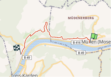
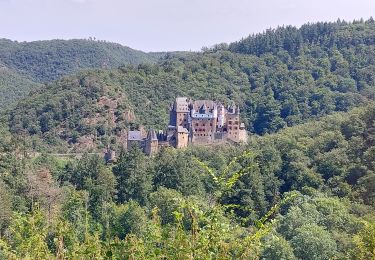
Ruta A pie de 4,7 km a descubrir en Renania-Palatinado, Landkreis Cochem-Zell, Müden (Mosel). Esta ruta ha sido propuesta por SityTrail - itinéraires balisés pédestres.
Descripción
Symbol: grüne Wegweiser, weiß beschriftet mit Wegnamen
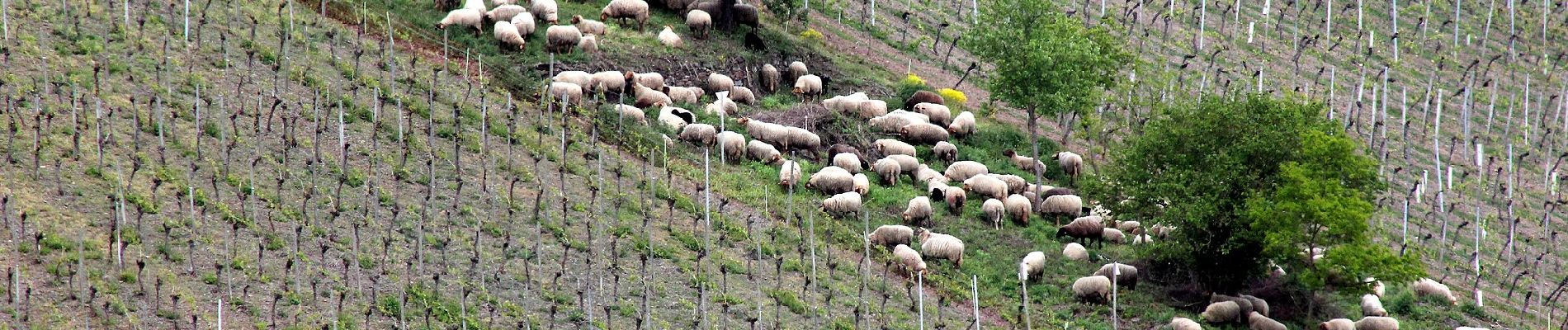
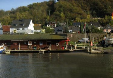
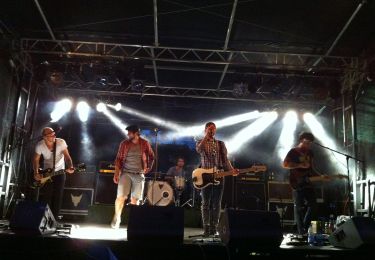
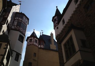
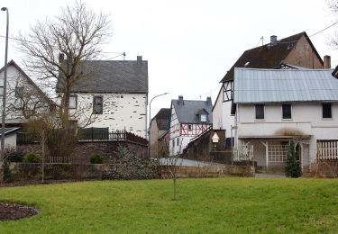
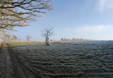
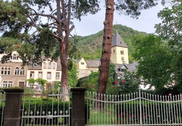
Localización
País:
Germany
Región :
Renania-Palatinado
Departamento/provincia :
Landkreis Cochem-Zell
Municipio :
Müden (Mosel)
Localidad:
Unknown
Salida:(Dec)
Salida:(UTM)
381348 ; 5560548 (32U) N.
Comentarios
Excursiones cerca
![Excursión A pie Burgen - Forellenweg - Photo](https://media.geolcdn.com/t/375/260/ced9dd62-857a-4a6e-9a35-70bc102c6483.jpeg&format=jpg&maxdim=2)
![A pie A pie](https://static1.geolcdn.com/sitytour/trail-icons/100.png)
Forellenweg
A pie
Fácil
Burgen,
Renania-Palatinado,
Landkreis Mayen-Koblenz,
Germany
![](/images/other/stat-length.png)
11,5 km | 15,7 km-effort
3h 33min
![](https://static1.geolcdn.com/siteimages/upload/files/16400158638029165_repeat_loop_refresh_sync_direction_icon.png)
Sí
![Excursión A pie Pommern - Lenus-Mars-Weg - Photo](https://media.geolcdn.com/t/375/260/41b145dc-0454-4640-9a4b-0137325b24df.jpeg&format=jpg&maxdim=2)
![A pie A pie](https://static1.geolcdn.com/sitytour/trail-icons/100.png)
Lenus-Mars-Weg
A pie
Fácil
Pommern,
Renania-Palatinado,
Landkreis Cochem-Zell,
Germany
![](/images/other/stat-length.png)
4,9 km | 7,5 km-effort
1h 42min
![](https://static1.geolcdn.com/siteimages/upload/files/16400158638029165_repeat_loop_refresh_sync_direction_icon.png)
No
![Excursión A pie Pillig - Burgentour - Burg Pyrmont zur Burg Eltz - Photo](https://media.geolcdn.com/t/375/260/10bc4a8d-226f-4721-8fad-d7b74b4a89ee.jpeg&format=jpg&maxdim=2)
![A pie A pie](https://static1.geolcdn.com/sitytour/trail-icons/100.png)
Burgentour - Burg Pyrmont zur Burg Eltz
A pie
Fácil
Pillig,
Renania-Palatinado,
Landkreis Mayen-Koblenz,
Germany
![](/images/other/stat-length.png)
4,7 km | 5,8 km-effort
1h 18min
![](https://static1.geolcdn.com/siteimages/upload/files/16400158638029165_repeat_loop_refresh_sync_direction_icon.png)
No
![Excursión A pie Brohl - Eifelhöhen und Brohlbachtal - Photo](https://media.geolcdn.com/t/375/260/3f47b296-66a8-49fd-bf11-b0357868deab.jpeg&format=jpg&maxdim=2)
![A pie A pie](https://static1.geolcdn.com/sitytour/trail-icons/100.png)
Eifelhöhen und Brohlbachtal
A pie
Fácil
Brohl,
Renania-Palatinado,
Landkreis Cochem-Zell,
Germany
![](/images/other/stat-length.png)
10,5 km | 13,1 km-effort
2h 58min
![](https://static1.geolcdn.com/siteimages/upload/files/16400158638029165_repeat_loop_refresh_sync_direction_icon.png)
No
![Excursión Senderismo Wierschem - château Eltz - Photo](https://media.geolcdn.com/t/375/260/8fb83b2e-7743-4c13-b116-8952048af505.jpg&format=jpg&maxdim=2)
![Senderismo Senderismo](https://static1.geolcdn.com/sitytour/trail-icons/101.png)
château Eltz
Senderismo
Fácil
Wierschem,
Renania-Palatinado,
Landkreis Mayen-Koblenz,
Germany
![](/images/other/stat-length.png)
10,2 km | 14,6 km-effort
2h 16min
![](https://static1.geolcdn.com/siteimages/upload/files/16400158638029165_repeat_loop_refresh_sync_direction_icon.png)
Sí
![Excursión Senderismo Moselkern - ringelsteiner muhle vers village Moselkern - Photo](https://media.geolcdn.com/t/375/260/a04f7489-af69-45e0-a57c-303763cc413c.jpg&format=jpg&maxdim=2)
![Senderismo Senderismo](https://static1.geolcdn.com/sitytour/trail-icons/101.png)
ringelsteiner muhle vers village Moselkern
Senderismo
Medio
Moselkern,
Renania-Palatinado,
Landkreis Cochem-Zell,
Germany
![](/images/other/stat-length.png)
7,1 km | 10,6 km-effort
2h 17min
![](https://static1.geolcdn.com/siteimages/upload/files/16400158638029165_repeat_loop_refresh_sync_direction_icon.png)
Sí
![Excursión Senderismo Moselkern - Moselkern balade au château allée et retour - Photo](https://media.geolcdn.com/t/375/260/a6e6df08-0ab7-450b-81cb-454a1fdd81d3.jpg&format=jpg&maxdim=2)
![Senderismo Senderismo](https://static1.geolcdn.com/sitytour/trail-icons/101.png)
Moselkern balade au château allée et retour
Senderismo
Difícil
Moselkern,
Renania-Palatinado,
Landkreis Cochem-Zell,
Germany
![](/images/other/stat-length.png)
9,9 km | 14,4 km-effort
3h 18min
![](https://static1.geolcdn.com/siteimages/upload/files/16400158638029165_repeat_loop_refresh_sync_direction_icon.png)
Sí
![Excursión Senderismo Müden (Mosel) - SityTrail - Château d'Eltz 2023 prévu - Photo](https://media.geolcdn.com/t/375/260/ext.jpg?maxdim=2&url=https%3A%2F%2Fstatic1.geolcdn.com%2Fsiteimages%2Fupload%2Ffiles%2F1553511878bg_sport_marche.png)
![Senderismo Senderismo](https://static1.geolcdn.com/sitytour/trail-icons/101.png)
SityTrail - Château d'Eltz 2023 prévu
Senderismo
Muy difícil
Müden (Mosel),
Renania-Palatinado,
Landkreis Cochem-Zell,
Germany
![](/images/other/stat-length.png)
18,1 km | 25 km-effort
5h 51min
![](https://static1.geolcdn.com/siteimages/upload/files/16400158638029165_repeat_loop_refresh_sync_direction_icon.png)
Sí
![Excursión Senderismo Wierschem - Eltz back - Photo](https://media.geolcdn.com/t/375/260/ext.jpg?maxdim=2&url=https%3A%2F%2Fstatic1.geolcdn.com%2Fsiteimages%2Fupload%2Ffiles%2F1553511878bg_sport_marche.png)
![Senderismo Senderismo](https://static1.geolcdn.com/sitytour/trail-icons/101.png)
Eltz back
Senderismo
Medio
Wierschem,
Renania-Palatinado,
Landkreis Mayen-Koblenz,
Germany
![](/images/other/stat-length.png)
4,2 km | 0 m-effort
1h 36min
![](https://static1.geolcdn.com/siteimages/upload/files/16400158638029165_repeat_loop_refresh_sync_direction_icon.png)
No